Ghosts of Mule Hill

I imagine it must have felt much like this. The ground soft from recent rains, the air fresh and crisp, and the clouds struggling to clear out of the dreary San Diego sky. One hundred and fifty years ago, American soldiers walked this same trail trying to get to San Diego. We call their destination Old Town now, but for them it would be the end of a long and dangerous journey from Fort Leavenworth in Kansas. My goal was far less ambitious. I was hunting geocaches.

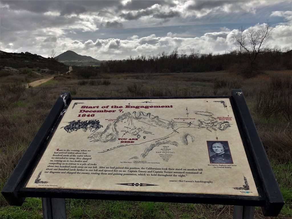
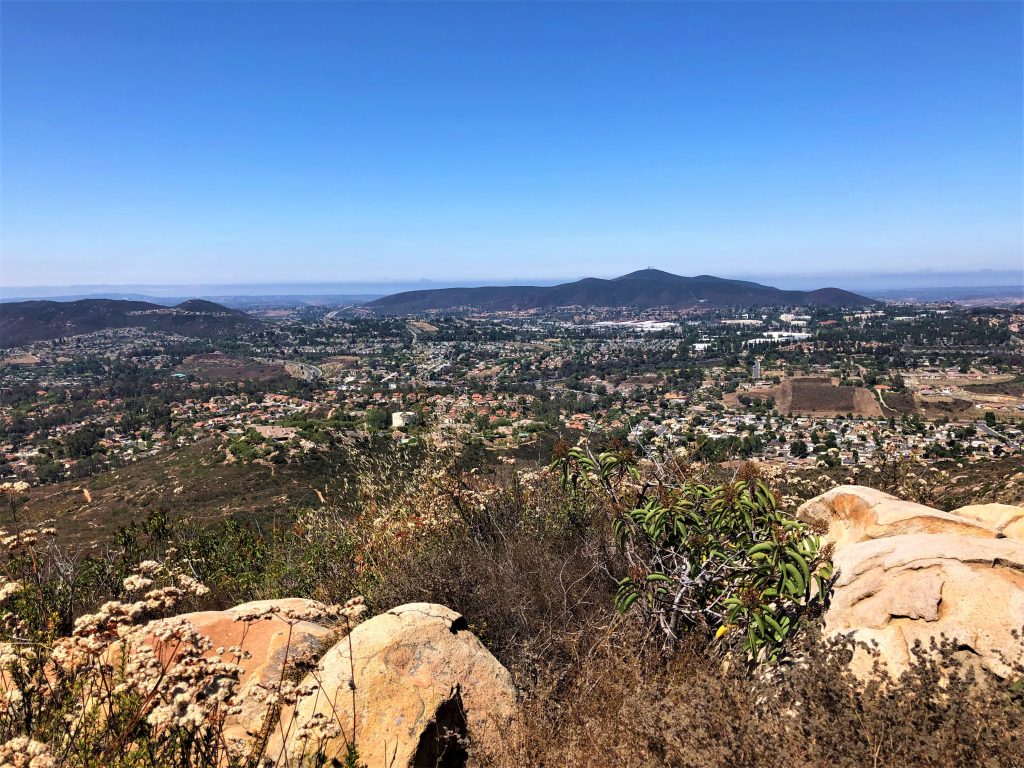
The trail leading into the San Dieguito River Park is part of the new Coast to Crest trail, an impressive 50+ mile hike from the Pacific Ocean to the summit of Volcan mountain. The trail itself is not at all new, but was used as a stagecoach route during the 1800’s, and was probably used by the Kumeyaay Indians long before that. I arrived at the first information sign and learned that this was the exact spot in 1846 that the Americans encountered the Californios, an army of Mexican soldiers led by General Andreas Pico. I’m certain that the Americans weren’t thrilled to see them. An attack by the Californios the previous night, done in a cold, foggy December drizzle, had led to significant casualties. That attack, now known as the Battle of San Pasqual, was one of the bloodiest in the ongoing war with Mexico. The Americans were exhausted, battered, and cold, and now they were surrounded.

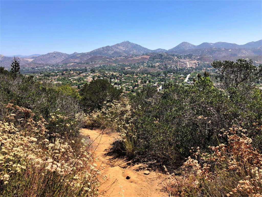
            The Americans fled to the hill on my left, and apparently lost cows and chickens right about where the geocache was hidden. Fortunately, I didn’t have to dodge the long poles and lances of the Californios in order to make my first find. GC725Q0 is an easy geocache located very close to the information sign.

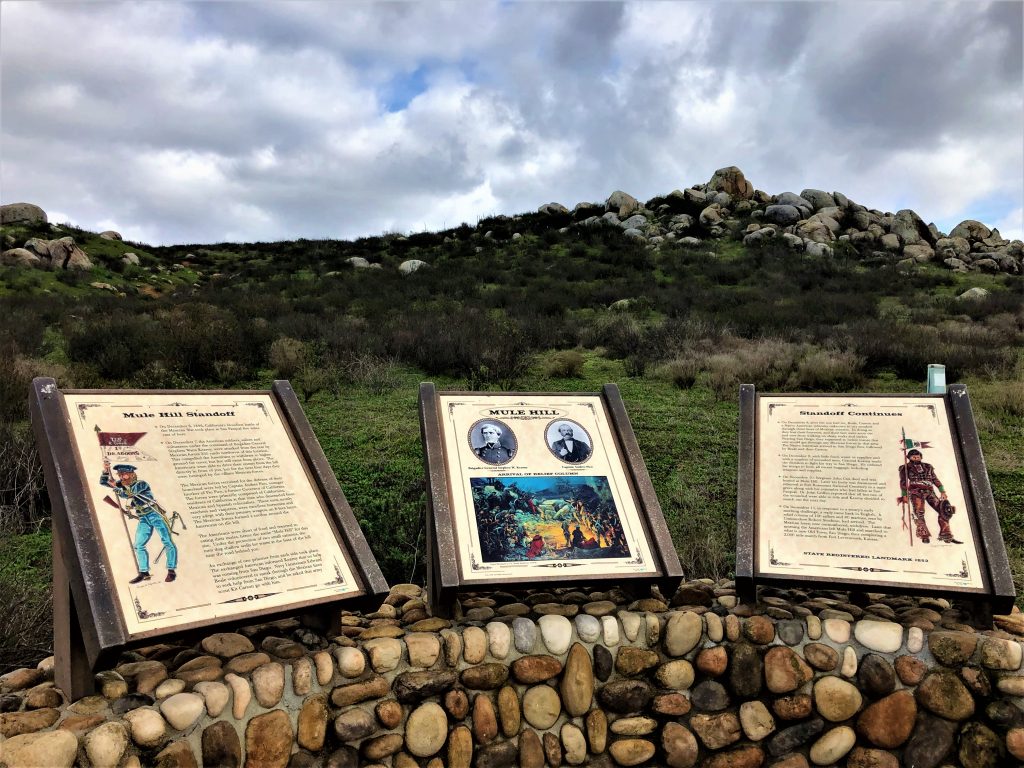
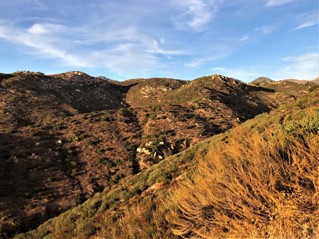
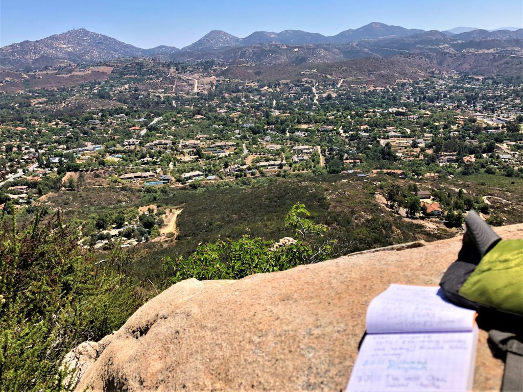
A little further down the path, I got a better view of the rocky hilltop now known as Mule Hill. The American troops camped near the saddle between the two hills, and had a makeshift medical unit to care for the wounded. One of these injured men was Capt John Cox, who eventually died while they were holed up on the hill. Having been lanced through the gut in the previous skirmish, I imagine his final hours were brutal. Excruciating pain, freezing temperatures, campfires muted by the mist and drizzle, and a severe shortage of food. The surviving troops avoided certain starvation by eating one of their mules, which gave the unassuming hill its iconic name. The story of how Kit Carson snuck out of camp, avoided the Californios, and walked to San Diego for reinforcements remains one of the great stories of the founding of California. The signs here give a glimpse of the action, and a geocache here (GC6EWCZ) provides more detail.

The history of the battle of San Pasqual is quite fascinating and the names of the major players read like a who’s who of San Diego landmarks. There was General Kearny (Kearny Villa Rd, Kearny Mesa), Captain Gillespie (Gillespie Field), General Pico (several streets in San Diego are named after him), Philip Crosthwaite (Crosthwaite Circle in Poway), and the scout Kit Carson (Kit Carson Park in Escondido). There has also been much confusion about the site. Looking to the South, a cross atop Battle Mountain in the distance is a reminder that Mule Hill was misidentified for many years. There was also a great deal of controversy over whether John Cox is still buried there. It seems like his body was likely moved, but the ghosts of Mule Hill are still very present. For an excellent description of the battle of San Pasqual and Mule Hill, click here.

Mt Whitney Cemetery

I have traveled to Lone Pine, California for each of the last two summers. The main draw for me is, of course, Mt Whitney. This hike is on many bucket lists and I was fortunate enough to snag an overnight permit in 2019 for some unforgettable camping. That, however, will be the subject of a future post.

Lone Pine has a lot more to offer than a ridiculously brutal day hike. Alabama Hills is a nice spot, there is an abandoned gold mine to explore nearby, and after losing 10,000 calories on Whitney, there are a few nice restaurants to tank up. One spot that doesn’t get a lot of press is the Mt Whitney Cemetery. I came here after my two day hike up and around Whitney (and my sleepless overnight at Outpost Camp), and when I felt like I wasn’t too far off from just pounding in my own tombstone and calling it an eternity.

Entrance sign

The Lone Pine area is home to several interesting resting spots for some of the earliest settlers to the area. Mt. Whitney Cemetery, founded in 1864 by the Knights of Pythias (during their very early days), is probably the most well known and certainly the largest, being the final resting spot for hundreds of souls and souls to be (it’s still an active cemetery). Located just north of Lone Pine, and offering spectacular views of Mt Whitney to the west and the Inyo range to the east, it is an idyllic place for a final resting spot.

Mt Whitney Cemetery looking toward Whitney peak

There are a number of very early graves here, most likely the earliest settlers to the area. I also like the fact that Gustav Marsh is buried here (he was instrumental in the construction of the Mt Whitney Trail that we all enjoy). The place has an eerie reverence about it, as if those buried here know they have won the cemetery lottery. I mean, it must suck to die but to be located in such an imposing place seems like a reasonable perk. I’ve seen some pretty uninspiring final resting places in my day… but this one would be high on my list.

I was also impressed by the diversity of tombstones. Some are very nice and a few represent an entire family plot. Others in the area are simply rickety wooden crosses with no name or information. Some are for infants or young children (they always get me right in the feels) and some are for anonymous folks. Lots of interesting/tragic stories are buried in these graveyards and I would love to spend some time to figure out how these people came to wind up here. Life stories and death stories are both fascinating!

Mass grave from the 1872 Lone Pine Earthquake. Whitney peak in background.

Across the street from Mt Whitney cemetery is a fairly nondescript fence enclosing the mass grave of a bunch of victims from the massive earthquake that occurred in Lone Pine back in 1872. There was a moderate earthquake in the area in June, 2020 that caused damage to the Whitney trail. The 1872 earthquake was almost 1000 times more severe, destroying most of Lone Pine. There is a plaque here and a cool virtual geocache (GC9345), but while I was here (pretty much all alone), I had a visit from Alice. Alice was a little girl killed in the earthquake and buried in the mass grave. She seemed playful and wanted me to visit the nearby pedunculate oak (GC81Z34), which I did. I grabbed a couple of acorns from the tree to try to grow here in San Diego (actually I’ve tried twice now) and haven’t had much luck. Maybe she just does this to get me to visit her more often!

Halloween and the Changing Seasons

Happy Halloween and a very Blessed Samhain to all of you boys and ghouls! It’s been a bit since my last post, and it has been a very challenging year with Covid looming over our life, but I’ve had a lot of time to think about what I want to do with this blog. I’ve decided to tweak things a bit as I start a new project. I’ll still be posting about my geocaching adventures but you will also be getting some teasers about this new dark and spooky endeavor. This Samhain seemed like a very powerful day to post this intention as it falls on a full (and blue!) moon. So, wish me luck, stay healthy, and always look for the beauty in darkness…

Haunted Columbus Pt 2

One of the haunted sites I visited during my recent trip to Ohio was at the confluence of the Scioto and Olentangy rivers in Columbus. The cache was called ‘British Island’ (GC2K8AX) by user Sweetfyre, and the area is supposedly haunted by the ghosts of prisoners who tried to escape from the penitentiary located nearby. After a little digging I found there are a number of possible stories to account for the ghostly screams heard in the area.

Downtown Columbus from the confluence

According to the Columbus Ohio Ghost Hunter Guide by Jannette Quackenbush (link), one possible ghost was that of an Indian mother, a member of the Mingo tribe (not to be confused with the oldest active geocache with the same name). On a beautiful Fall day in 1774, Colonial William Crawford led a column of British troops to remove an Indian settlement along the banks of the Scioto river, just south of the confluence. Chaos ensued as the shooting started, and one mother frantically searched for her young child. Grabbing him in her arms, she tried to flee but was struck down in a hail of musket balls. As she lay dying, she looked into the terrified eyes of her child for the last time and told him to hide. He obeyed, hiding inside the hollows of a dead tree for two days before he was finally found. Some claim the cries are from the boy’s mother, searching for him still even in death.

This was one of those caches where the search was almost as creepy as the story. GZ is located some distance away from the nice view, and there had been recent reports of people camping in the area. After waiting out a few cars and getting an odd look from a jogger (I’m sure she suspected we were either muggers or geocachers), we hopped over the guardrail and into the brush. There was a lot of trash and suspicious material back there, but we didn’t encounter any two-, four-, or eight-legged threats. The cache was hidden in a familiar spot, so fortunately we didn’t have to hang around too long.

Another creepy spot in Columbus is the Schwartz Castle, located on 3rd street in German Village. Admittedly, we originally came to this area for the (excellent!) deli across the street, but I couldn’t help but check this place out after we ate. The story here starts like so many other tragedies. Guy moves all the way to America from Germany in the mid-1800’s, builds a huge house for his fiancé, then gets a letter from his soon-to-be-ex fiancé who tells him she is staying in Germany and marrying some other guy. Ouch. Well, Fred Schwartz did what many of us guys are tempted to do in this situation – he went bat shit crazy. Personal hygiene went out the window, he became vegan, and he drank nothing but rainwater long before these were trendy things to do.

Schwartz Castle

He also did a LOT of nude sunbathing on the top of the building and it is said that his ghost haunts that area. (The spirit of a nude septuagenarian sunbather… yikes!) There have also been reports of bodies buried in the basement, murders, and who knows what happened after the place was condemned in the 1970’s, but the place is a lot less creepy now. The geocache that brought me here (GC321HG) also by user Sweetfyre, is a sneaky little nano hide but a great placement for the all the muggles in the area (living or otherwise). I loved using these geocaches to explore the dark and creepy parts of Columbus!

International Geocaching Day

Did you find a geocache on Saturday for International Geocaching Day? I was pretty busy so I figured that I was going to have to settle for a boring park-n-grab to get my souvenir.

The souvenir! Artwork by geocaching.com

The cache I found was more or less a PnG, but it was definitely not boring. It was a cache called ‘Old Road’ by Dillweed (GC7J5AQ) and is located midway down the Poway grade (Poway road between Espola Rd and the 67). There is a pullout there which I had used for a nearby cache in the past, and some care needs to be used when parking. The path to the cache takes you along the edge of Rattlesnake Canyon, with breathtaking views of Black Mountain, Poway, and the Pacific Ocean to the west, and the summit of Mt. Woodson to the northeast.  It was a lovely location and I even caught a glimpse of the cave in the canyon below (which reminds me, I DNF’d that cache (“Poway Cave” GCN4VJ) many years ago… maybe I should go back!). One of the things I love about geocaching is that it often takes me to go places I would never know to explore. This was a classic example! Even though the geocache was very straightforward, I now know of a gorgeous, secluded place to come watch a fabulous west coast sunset.

Looking NE from GZ near sunset. Rattlesnake Canyon below, and a peek-a-boo view of the Mt. Woodson summit left of center

Mystery at the Museum: Twin Peaks

My career as a gumshoe detective was fun but short-lived, as the Mystery at the Museum promotion ended last week after a month. After a bumpy start, things went smoother and I was able to find all of the clues. Collecting all of the virtual jewels was a bit harder. I mean, they were scattered all over the place! I was finding them in Ramona, Coronado, and Poway! The virtual detective assigned to me was getting pretty impatient, and so for my final assignment, she sent me up to both summits of Twin Peaks in Poway to finish collecting the missing jewels. “I don’t wanna go up there,” I whined. “Can’t I do some park-and-grabs?” She doesn’t speak much, but her virtual face suggested there was going to be a not-so-virtual problem if I didn’t load up a backpack and get moving.

I’ve been up Twin Peaks once before, about 9 years ago, and so the first part of the trail was quick since I already found many of the lower caches. My first stop was ‘Another Star in Poway’ by T.R. Violin (GCPDYD). Hidden in 2005, the cache was in amazingly good shape and a quick find. This cache also marked the position of the trail up to the summit, and after this point the road was winding and steeper. I met an older gentleman coming down the trail and he warned me that the back side of the trail was much steeper than the front face. I had a cache to grab a few hundred feet down the back side and getting down there was almost as treacherous as climbing back up. It was worth it though because the cache I found (‘Snakes Alive!’ by Habu (GC2PQHX)) had only been found once in the last two years.

View of Black Mountain and the Pacific Ocean from the west summit
Trail the summit looking east with Mt Woodson in the background

The final cache of the day was actually a repeat. The cache was named ‘Merry Christmas 2009 – Twin Peaks’ (GC226A1) and I had originally found the cache back in January of 2011 with my two oldest daughters. I remember that cache well because we had just moved to California, and I had just started caching so it represented one of very first geocaching adventures. I also remember being a little skittish about the exposure required to get to GZ, but it seemed so trivial this time. Goes to show you what a decade of SoCal hiking experience will do. I’m still skittish about heights, but at least it is a little less embarrassing now. It was cool to find the original logbook and our nearly nine year old entry. It looked like my daughter actually wrote the log, which was cool. I hung out in this quiet little spot for awhile, enjoying the shade and the view. It also seemed like a good place to hang out from the law because after completing the search for the jewels, the virtual detective told me I had to find 35 MORE caches to successfully return them to the safe. Wait, what? Return the jewels? Nobody said nuttin’ ‘bout returning the ice, see. I’s gots ‘em now and dat gumshoe’s gonna have ta catch me if she wants ta send me ta da Big House…

View from the west summit. Logbook with our 2011 entry…

Mystery at the Museum: Beeler Canyon

I am still working on the new promotion at Geocaching.com called Mystery at the Museum (MatM), a month long game-within-the-game in which geocachers can earn several cool, new badges. For details, click (here). For the details of finding my first clue, click here.

After my less than spectacular search at the 4:10 cache, I was determined to prove to the virtual detective that I was up for this case. Combing through the case files that she gave me and making good use of the filters on the geocaching.com website, I surmised that Beeler Canyon might be a good spot to initiate my search for clues. Beeler Canyon is kind of an odd place, sandwiched between the Stonebridge neighborhood in Scripps Ranch and the back side of the technology park near Costco. The beginning of the road has some nice homes, then there is more of a farm-like area, and then it opens up into an empty canyon. The Vulcan Materials company owns some of the land, and the area also serves as an escape route for Stonebridge, with fire roads dropping steeply down to the canyon. Towards the end of Beeler Canyon road are some nice trailheads into Sycamore Canyon.

The door to the hobbit house…

Two of the three caches here that had clues were your garden variety park-n-grabs, but one (Beeler Road Rock Ruins, GC5YPPF) was located in a remarkable place. GZ was about 100 feet off the road, in a copse of trees within a fenced enclosure with only three sides. There was ample evidence of nefarious activity in the area, including broken beer bottles, drug paraphernalia, and some old clothes. I approached the trees carefully, listening for teens and watching for rattlers, and then the doorway came into view. The place was well hidden by the thick, dead brush and the overgrown trees. The doorway reminded me of an elven home out of Lord of the Rings. In fact, the whole building, or at least what’s left of it, was very otherworldly. The walls were imbedded with large stones and beer bottles, all of which seemed to have been put there on purpose. There was the usual smattering of graffiti, but some of the rocks were actually painted quite nicely. After a bit of exploring, I failed to find the stolen jewels, dead bodies, or any angsty teens. I did manage to find the cache pretty quickly and given the virtually infinite number of potential hiding spots at this site, I’m hoping for a virtual brownie point from the virtual detective. Anyhow, between the three Beeler Canyon caches, I collected one fingerprint and TWO shadows! Dun dun daaa! So I just need one more fingerprint and two footprints to move onto the next level. So I made good progress towards solving the MatM case and had a cool little adventure.

A blend of art and graffiti on the stone walls

Mystery at the Museum

Today marks the beginning of a new promotion at Geocaching.com. Mystery at the Museum (MatM) is a month long game-within-the-game in which geocachers can earn several cool, new badges. For the details, click (here). Although I spend most of my time playing Munzee, I do like these promotions because it gives you a chance to earn something other than a just a smiley.

Clue #1
(artwork from geocaching.com)

When I first heard about MatM, I wondered how they would be able to hide clues in the caches.  How hard would it be to crack the case? Would I need to break out my tweed suit and calabash pipe? Sadly, this promotion is similar to others by GCHQ, in that badges are earned based simply on geocache finds. The twist here is that the specific clues are earned only when a cache with that clue is found. Geocaching.com has added some new filters to the search map, so it is easy to see which caches qualify for a particular clue.

A 4:10 Nightmare! That’s a LOT of wood to search…

               The first clue I needed for MatM was the ‘Detective’ clue, which is required to have before you can look for the other clues. I set my filters to search for caches that would qualify me to meet this virtual detective, and there were about 30 within a mile or two radius of my house. I have no clue (pun intended) how these caches were selected. There was a mix of old and new, regular and puzzle, and even a few disabled caches were on the list. Seemed very random. Many of them I had already found (or were puzzle caches that would require significant upfront work!), but there were a few that I hadn’t found yet, including another one of the 4:10 series (4:10 to Poway GC72PW0, see this post for more info on the 4:10 series). I drove over at lunchtime and scoped out the scene. I didn’t see any bodies, weapons, jewels, or anything else related to the case. Just a whole lot of lumber to investigate. Although I have found several of these 4:10 caches, I don’t seem to be getting any faster at finding them. The virtual detective waiting to brief me on this case floated impatiently in the sun and shook her head in disgust as I fumbled around for the cache. When I finally found it in an area I had already searched once, she thrust the virtual case file in my chest and muttered, “Good luck, Sherlock. You’re gonna need it.”

Day 1 Badge: Briefed by the Virtual Detective. I’m already on her bad side. (Artwork from geocaching.com)

Although it may cast doubt on my abilities to solve a complex crime such as a jewelry heist, at least it wasn’t a DNF right? RIGHT?? Anyhow, I signed the log and logged the cache to get my first badge. This unlocked the next phase, where the goal is to find three different clues (2 of each type): a footprint, a fingerprint, and a SHADOW! Dun dun daaaa… tune in next time for MatM and see how bad I’m bungling the case.

Haunted Columbus

Recent travels sent me to Columbus, Ohio to visit an old friend. Our objectives for the trip were to catch the Memorial golf tournament, sample some of the fantastic food in Cbus, and, of course, geocaching. There were many to chose from, as the City of Columbus actively promotes geocaching. The city has even published caches as part of a GeoTrail, which may be the topic of a future post. As I scouted for interesting caches, I couldn’t help but be drawn to the Haunted Columbus series. Each cache led to a location with a particularly spooky story, and since most were in old graveyards, I simply couldn’t resist.

A funny epitaph, dark humor, or a family plot?

The first few led me to Greenlawn cemetery, a rather large collection of graves dating back to the mid- 1800’s. The first stop was ‘Hauntings – A Ghostly Good BYE’ by Sweetfyre (GC58R6F). This nearby tombstone was more whimsical than scary, and a fine example of dark humor, or at least I thought. Ironically, it was actually the Bye family plot.  We next ventured over to the Hayden crypt. You know the ghost story must be good when the cemetery goes to great lengths to keep people from waking the dead on their own. The wooden door to the crypt was protected by a rusty iron gate, but we still tried to summon the spirits with a few good raps. The mausoleum itself was a rather imposing structure, with columns on either side of the door and a red clay dome. The inside must look amazing.

The geocache (‘Hauntings – Hayden Mausoleum’ by Sweetfyre GC2CFD7) was hidden in an area behind the crypt that was plenty creepy in its own way. Previous logs talked of ghosts, security guards, and an angry beaver, so we had several things on our minds as we crept around. Thrashing about in the overgrowth, I noticed a small pond a few feet away.  Hidden in the shadows of the oaks, and covered in leaf debris and pond scum, it had its own morbid charm. I half expected a zombie security guard to grab me by the ankle and drag me into the murky depths! Thankfully, my muggle friend made the find here (his caching skills are impressive for a muggle), and I for one was glad to be out in the open again.

I found another interesting ‘cemetery’ on my own. I wouldn’t have noticed this even if I had driven by, but a cache at the location had the word cemetery in the title (‘Cemetery on King’ by Chemist Kahuna, GC6ATJG), so I decided to check it out. I got rock star parking right at ground zero. I was on King Avenue, near downtown, and the rather nondescript building looked like an old house that had been recently renovated. To be honest, all I noticed at first was a ‘for sale’ sign stuck in what was left of the grass in front. Next to the sign was the single, lonely gravestone of Sylvester D. Uline from the 2nd Ohio Infantry division. Who was this guy? Why is he buried all alone here? Is he EVEN buried here? (A past log suggested he may actually be buried in the Grove cemetery in Kenton, Ohio). It was a bit creepy but also a little poignant. The cache here was a real tough one, as there were dozens of places to look. The fact that you are searching along the sidewalk of a busy street, in the sightline of probably a dozen houses, made it even more difficult. Personally, I loathe these hides because I always feel like I’m casing out the joint. I was determined to find this one though, and after a 30+ minute search, I finally had my hands on the prize. Definitely worthy of the 4-star difficulty! Stay tuned for more creepy caches from Columbus!

TBT: Geocaching in Rhode Island (May 2014)

I work in the biotech field, and I am fortunate that part of my job is to travel.  In May of 2014, I was in downtown Providence, RI for a drug development conference.  I was excited about this trip not only for the great science, but also because I would find my first cache in Rhode Island. Woo!! As it turned out, I had very little time for caching, so my choices were limited to the ones around the hotel. There were several nanos down by Waterplace Park, so on my last night I ventured out to find them. The first one was “Providence Nano Series #12: Waterplace Park” by Aerial (GC2RG5C: Archived in 2018 after over 500 finds), a tough to find but very well-placed nano near a waterfront basin just rife with muggles! As you can see from the picture below, it was a gorgeous place to see the Woonasquatucket River and the State House. In the basin were a bunch of baskets of firewood, which I thought was rather strange (you can see them in the picture).

Waterplace Park in downtown Providence, RI
Rhode Island State House

I was able to get a closer view of the State House with another cache in this series, “#11 Station Park” (GC2RG42: Archived in 2018 after over 500 finds). This was another well-placed cache that took me awhile to find. I then got a call from the family back home in San Diego, who were dealing with serious wild fires at the time (we wound up being safe), so by the time I was ready for the next hide, it was almost dark. A number of people were amassing near the basin, and music was being piped into the area, so I decided to return to see what the hoopla was all about. What I saw was a true treat, and something I would have missed if it were not for geocaching. WaterFire! I started chatting with the guy standing next to me about what was going on, and apparently his son is a volunteer for this event, which only happens a few times each summer.

I had not waited long before I could see some shadows appear from the edge of the dock area. A procession of people, each carrying a sizable torch, walked silently through the crowd to the edge of the dock. Skiffs glided out of the shadows of the river, piloted by figures dressed in black cloaks. There appeared to be passengers in each boat, and it reminded me of Charon taking souls across the river Styx! Except in this case it was the river Woonasquatucket. The ferrymen guided their skiffs close to the dock and each took a torch to light the wood in the river.

WaterFire Festival, Downtown Providence

Soon there was a ring of fire pits burning around the basin, with music to fit the mood. The river sparkled from the rippling reflections of both fire and city. Skiffs glided silently from fire to fire, adding wood to keep the flames roaring. It was a really, really cool event. The vibe was very goth and creepy! Apparently, this was the first one of the year, and had been rescheduled based on the weather and the tides through the river, so I was very fortunate to have caught this event. I wound up hanging out down at the basin for over an hour, watching the boats tend to the fires, and taking in the sights, sounds, and smells, while enjoying the company of a few hundred of the locals. For more information on WaterFire, go to https://waterfire.org/.

Charon crossing the river Woonasquatucket

Speaking of goth and creepy, my last geocache in Rhode Island was also pretty special. I’m a huge fan of cemetery hides, and also a fan of H.P. Lovecraft, so when I saw a virtual cache at his grave (“H.P. Lovecraft” by Julia GC9497), I knew I had to make time for one more cache. I had no idea that he was buried here and so I took an extra 45 minutes driving back to Logan airport (after getting hopelessly lost on the south side of Pawtucket) looking for Swan Point Cemetery (http://swanpointcemetery.com/). What I found was one of the most beautiful cemeteries I have ever seen. A truly peaceful place, with interesting markers, blooming trees, and a true sense of reverence. It took me a bit to zero in on where his grave was, and apparently the cemetery folks monitor people who venture into this area. By the time I parked and walked over to his tombstone, security people were coming my way. I got the info I needed to log the virtual cache, but was told by security that no pictures were allowed. Fortunately, I took one before I got to GZ, so this at least gives you an idea of what the general area looked like. As is so often the case, I had two very memorable experiences on this trip thanks to well-placed geocaches.

Swan Point Cemetery, Providence RI