Creepy in Escondido

I believe there is a certain beauty in darkness, and often find a kind of peace in a creepy place that is hard to find elsewhere. So, I have a great appreciation for geocaches with a goth aesthetic. Recently, I was in north Escondido, CA with an hour or so to spare and found not one, but two really cool (ie, morbid) caches both by GRNZOOM. The first was “Belinda’s Valentine (RIP Charlie)” (GC6B71B). Located near a sharp bend on a lonely stretch of Mesa Rock Road, ground zero offered a convenient place to pull over. My eye was immediately drawn to a weathered memorial attached to a chainlink fence. To most folks, it was a solemn reminder of a life lost late at night, perhaps a speeding car failing to navigate the curve and shattering a family. For me, it seemed a likely place to begin my search, and I had the cache in hand moments later. It wasn’t the first time I have seen this type of camo used for a geocache, but I think it is awesome. Dark, creepy, and not likely to be disturbed by non-geocachers.

RIP dearly departed geocache

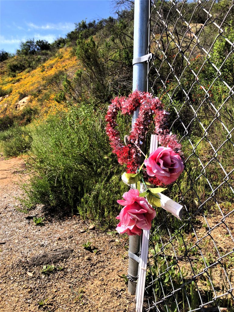
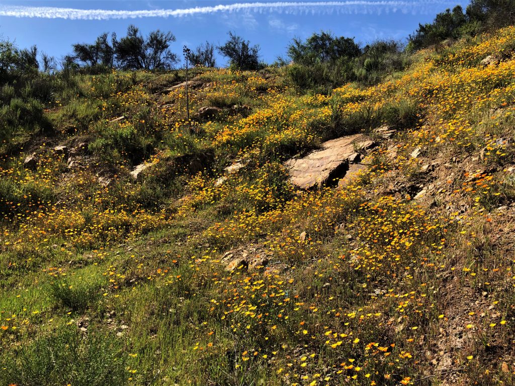
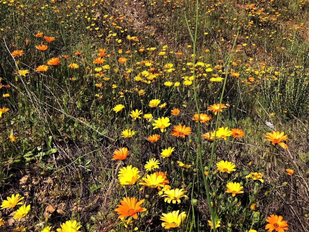
You may have noticed from the picture that I also discovered something else at GZ that I had been seeking. The superbloom! The hill behind the cache was ablaze with orange and red flowers, and the density gave the area an almost painted look from a distance. I appreciated the way Nature seemed to pay tribute to the faux memorial. Later, I discovered a real memorial under the nearby overpass which made it even more poignant.

Superbloom on the hill
So many flowers…

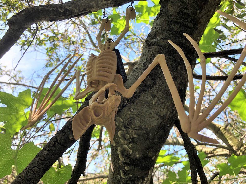
I was happy to have found a good spot to enjoy the flowers and to have found a creepy cache, but I was pleasantly surprised to find another hair-raising spot nearby. This geocache, “Happy Halloween: Bat Boy” (GC7YT1A) took spooky to a whole different level. Again, GZ had a convenient place to pull over and I was searching in an area thick with brush and branches. Runoff from the winter rains had left a deep rut connecting the roadway to a seasonal creek down the embankment. A large tree near there certainly seemed like a good place for a Halloween cache, but my GPS had me closer to the road. Searching the lower branches and bushes, as well as the ground for some evidence of a log or geopile, I wound up circling around my indicated GZ and ended up on a small rise. This placed my eye-level deeper into the foliage and when I happened to glance up, my heart nearly stopped. I can only imagine how loud I would have screamed if I had been night caching and happened to catch this sight in the beam of my flashlight. Signing the log and returning to my car, I had to chuckle to myself. Was I admiring the creepy creativity that went into these awesome (and often favorited) hides? Or was I laughing at my own disturbing appreciation of something so morbid?

Gotta admit… I may have let out a small scream

Black Canyon (Ramona, CA)

            With all of San Diego in a buzz about the recent Superbloom and the billions of butterflies migrating through the area, I thought I would take a drive out past Ramona and catch these once in a decade phenomena. Sadly, I saw neither out there. What I did find, however, was a very cool part of San Pasqual valley known as Black Canyon.

            Magnolia Avenue winds its way out of Ramona and through pastoral farms dotted with the occasional vineyard. Civilization comes to a rather abrupt end, as does the pavement. Black Canyon road continues as a narrow, dusty, pothole-laden trek around some very blind corners (better honk first). At a couple of spots, the road dropped off precipitously into gullies that seemed a popular dumping ground for various items. I shudder to think what kind of crap is hidden out of sight in the brush fifty feet below the road.

            The geocaching here is decent for a pseudo-powertrail, but a few precautions are in order. I made the drive in my passenger car (an Infiniti) and I never really felt too afraid of damaging the car or getting stuck in the sand. However, if it has recently been raining I would think a four wheel drive might be safer. Which brings me to the next point: cell service. My carrier, who will remain nameless, was pretty spotty out here and there were many stretches where I had no cell service at all. There was an occasional car on the road, but from a safety perspective, it is pretty desolate and so some preparation may be prudent. From the geocaching perspective, downloading the caches for offline use is essential.

The first few miles was very scenic, with a rugged, colorful, Mars-like landscape split by the lush, riparian boundaries of Santa Ysabel creek. There are also a number of good caches along this stretch. There are a few in the 4:10 series (for example GC6YB2M) because as KikbakJack would say, “it’s always 4:10 to somewhere”. If you haven’t done this series, I recommend it. Once I got the hang of what I was looking for, they became really fun. Another notable cache is GC2V2KW, also by KikbakJack. It’s a classic ammo can at a spot with a nice view.

One of the big highlights of the trip was at the intersection of Black Canyon road and Sutherland Dam road. Although a modern, surprisingly nice bridge crosses the creek here, the original Black Canyon bridge has been left behind. Built in 1913, it is one of the last surviving examples of what is known as the “Thomas System Bridge” or the “three-hinge arch”. These bridges were built by the Thomas and Post company (Los Angeles) and were innovative in two ways. Unlike most bridges, which are built at the site, the arch ribs and spandrel columns of the Thomas System were precast and then assembled at the site.  Three hinges (basically connection points designed to absorb movements due to stresses, ground movements, and temperature changes) were made, two at each foundation footer, and one at the top of the arch.  The hinge at the arch was unusual for the time, and likely made the shipment of the precast pieces easier to manage.

As I stood on this lonely bridge in the middle of nowhere, I couldn’t help but wonder what kind of shenanigans had occurred here. Over a century of teen parties for sure, probably a fatal accident or two, and there was even a body dumped from here in 1977 (David Hargis, killed by his wife and thrown over the bridge). It was a little creepy in the daytime, so if anyone has heard some good ghost stories about the area, I’d love to hear about them! Sadly, the geocache hidden here (GC2V2RE) was missing, but visiting this bridge was the highlight of the trip.

I did not cross the shiny new bridge, but opted to head up Sutherland Dam road to see the reservoir. The views here did not disappoint either! The dam has a very unusual shape and is quite beautiful, with its sandstone-like coloration. Although construction began in 1927, money issues and political squabbles (apparently this is not just a modern-day issue) delayed completion until 1954. Interestingly, one of the stories about why it was named after Sutherland comes from the book “On Memory’s Back Trail” by Darrell Beck. In the book, Beck discusses a story about how Sutherland helped out a civil engineer named Post, who wound up cold and drenched at Sutherland’s home while surveying for the dam. Could this be the same Post from the Thomas and Post company in LA who built the Black Canyon Bridge? Geocaches in the area (particularlyGC794G1 and GC1ZY2W) offer nice views of the dam and Lake Sutherland. I hit a few more caches along Sutherland Dam road and it eventually led me back to SR 78. This was a wonderful little loop, containing many fine geocaches, some gorgeous views, and some truly unique California history.